Nine atmospheric rivers overwhelmed California in 2023: Watch the storms unfold
California’s extreme 2022–2023 winter was fueled by back-to-back atmospheric rivers. Research research from Berkeley Lab suggests these events could worsen in a warming climate.


During the 2022–2023 winter season, California experienced nine atmospheric river events in succession, resulting in the state’s longest period of continuous atmospheric river (AR) activity in at least 70 years. The impacts were substantial: severe flooding, destructive landslides, and prolonged power outages.
New research from Lawrence Berkeley National Laboratory (Berkeley Lab) offers insights into how and why these extreme events occurred—and why they are likely to become more common.
What Are Atmospheric Rivers?
Atmospheric rivers are long, narrow corridors of water vapor in the atmosphere that transport moisture from the tropics toward the poles. When these systems encounter land, they can release enormous volumes of rain and snow, particularly along the West Coast of North America.
While these systems are not new, their frequency, intensity, and behavior have become a subject of concern, particularly in the context of climate change.
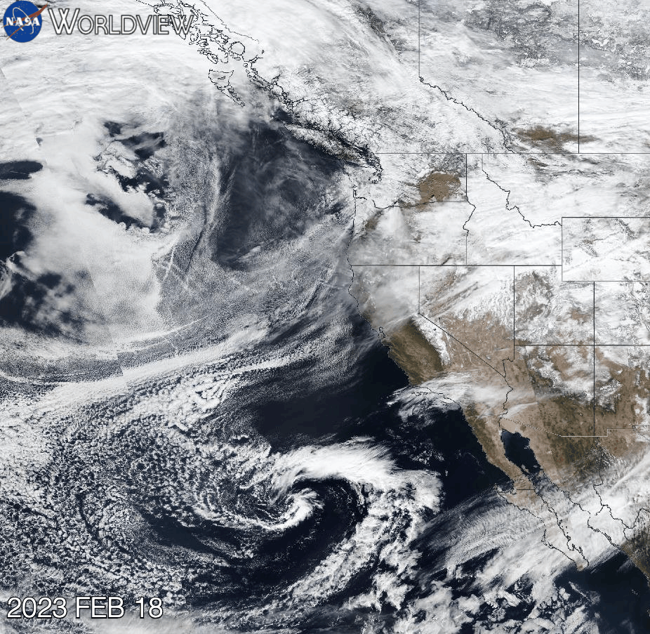
NASA Visualization: 2023 Atmospheric Rivers Over California
The interactive and informational satellite imagery below, developed by NASA’s Worldview tool, captures and provide key details on the sequence of atmospheric rivers that made landfall across the U.S. West Coast. The satellite imagery covers the period from February 18 to March 12, 2023—one of the most impactful stretches of the season, incorporating various additional data layers.
Among many other insights, NASA's data highlights the persistent flow of moisture-laden systems striking the California coastline, reinforcing findings from climate scientists that these events are becoming increasingly clustered and extreme.
Research Insights: Clusters, Climate, and Consequences
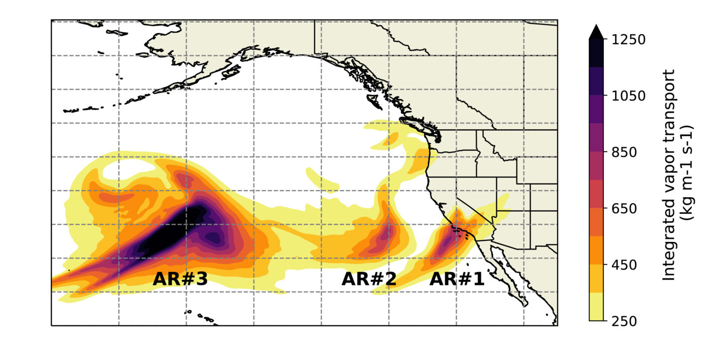
In a study published in Communications Earth & Environment, researchers at Berkeley Lab used machine learning to examine AR behavior, focusing on what they describe as “clusters”—multiple atmospheric rivers occurring over a short time frame.
Lead author Yang Zhou, a scientist in the Earth and Environmental Sciences Area (EESA) at Berkeley Lab, explained:
“Atmospheric river events are likely to become worse with rising temperatures. By studying how and why more dense events occur, we can try and help California be better prepared.”
Key Findings
1. Cluster Density Correlates With Severity
The team introduced the concept of “cluster density,” which measures how many days within a multi-day cluster qualify as AR days—i.e., days when an atmospheric river makes landfall and releases precipitation. High-density clusters were found to produce more extreme weather conditions.
2. Reduced Recovery Time Between Events
In densely packed AR clusters, the land is subjected to repeated rainfall with minimal time to recover. This leads to saturated soil, greater runoff, and higher risks of flooding, landslides, and infrastructure failure.
3. Climate Change Increases Cluster Likelihood
The study linked dense AR clusters to specific atmospheric conditions—such as variations in pressure and wind—that are becoming more frequent in a warming climate. These conditions foster environments conducive to extreme, successive AR events.
Implications for California’s Preparedness
The study highlights the urgency of improving California’s infrastructure, emergency response systems, and climate modeling capabilities. As atmospheric river events become more frequent and more intense, understanding their clustering behavior will be critical for mitigating damage and protecting communities.
This research was conducted using data from the National Energy Research Scientific Computing Center (NERSC), a Department of Energy Office of Science user facility at Berkeley Lab.


