How to use California’s interactive mine and mineral resource maps
Learn how to navigate California's Mines Online (MOL) web map to explore real-time data on mine locations, statuses, and mineral production.


California is home to a diverse range of mineral resources, and thanks to modern mapping technology, residents, researchers, and policymakers can now explore the state’s mining data with ease. The Mines Online (MOL) web map, managed by the California Department of Conservation’s Division of Mine Reclamation (DMR), provides an interactive look at active and historic mines, their mineral output, and regulatory status.
This guide will walk you through how to access and use MOL, along with other key interactive mapping tools offered by the California Geological Survey (CGS) for understanding the state’s mineral land classification system.
What is the Mines Online (MOL) Web Map?
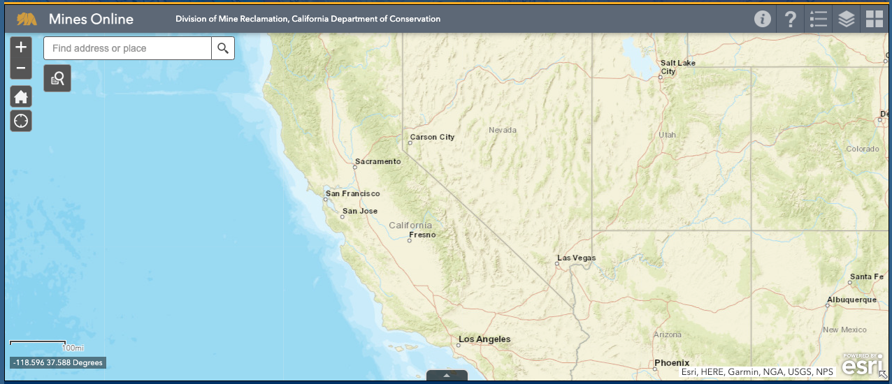
The Mines Online (MOL) web map is a real-time geographic database displaying information about mines across California. It is designed for public use and serves as a valuable tool for:
- Researchers and Geologists tracking California’s mining activity.
- Local governments planning land use near mining operations.
- Environmental and conservation groups monitoring reclamation efforts.
- Residents and businesses interested in mineral resource areas.
What Can You Find on the Map?
The MOL web map provides data on:
- Mine locations across the state.
- Active vs. inactive mines, including their AB 3098 compliance status.
- Ownership and regulatory details for each operation.
You can access the Mines Online (MOL) web map here: MOL Interactive Map
How to Use the Mines Online (MOL) Map
Navigating the MOL web map is simple. Follow these steps to make the most of the tool:
1. Open the Interactive Map
- Click on this direct link to the MOL map to launch the web interface.
- The map will load with pre-set layers displaying mine locations.
2. Search for a Specific Mine or Region
- Use the search bar to enter a mine name, mineral type, or county.
- Zoom in and out using the map controls to explore different areas.
3. Interpret the Data Layers
- Mine Symbols: Active mines appear in bold markers, while inactive mines are grayed out.
- Commodity Filters: Toggle between different minerals (e.g., gold, limestone, aggregate).
- Regulatory Status: Mines in compliance with AB 3098 (reclamation standards) will be noted.
4. Click for Detailed Mine Reports
- Selecting a mine on the map will open a pop-up window with:
- Ownership details
- Annual mineral production data
- Environmental compliance status
More Mapping Resources from CGS
Beyond the MOL web map, the California Geological Survey (CGS) offers additional interactive tools that provide deeper insights into the state’s mining and geological landscape.
1. Mineral Land Classification (MLC) Map
- Identifies areas with significant mineral resources.
- Helps local planners and policymakers protect key mining zones.
- Access the MLC Interactive Maps
2. Earthquake and Landslide Risk Mapping
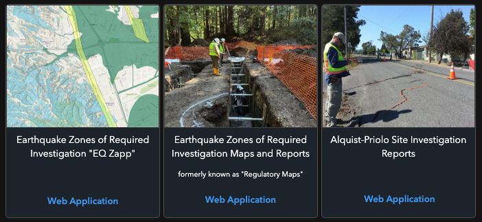
- Earthquake Zones of Required Investigation ("EQ Zapp") – Interactive tool for exploring areas at risk of seismic activity.
- Alquist-Priolo Site Investigation Reports – Data on fault zones and seismic hazards affecting land development.
- Landslide Inventory – Tracks areas prone to landslides, crucial for mining safety.
3. Tsunami and Geological Hazards Map
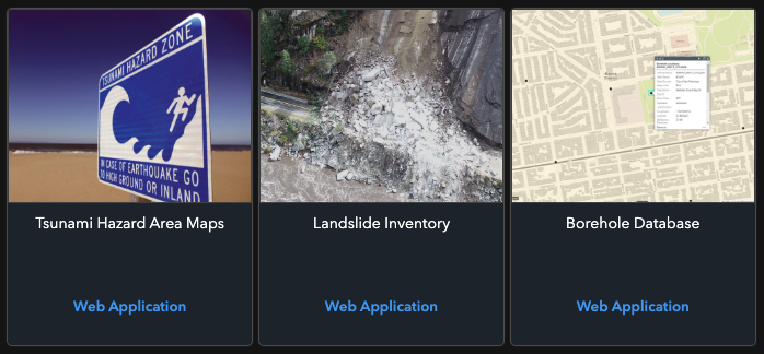
- Tsunami Hazard Area Maps – Identifies regions where tsunamis could impact coastal and inland infrastructure.
- Borehole Database – Provides subsurface geological data useful for mining and construction.
- California Mineral Resources Data Portal – A centralized hub for mineral and geological data.
- Explore Tsunami & Geological Hazard Maps
These interactive mapping tools are invaluable for geologists, environmental researchers, land-use planners, and industry professionals looking to make informed decisions about mineral resource management and natural disaster preparedness in California.
Why These Maps Matter
California’s mineral resources play a crucial role in infrastructure, construction, and industry. By utilizing these interactive maps, residents, researchers, and businesses can better understand the state’s geological assets and mining footprint.
Whether you’re a scientist conducting mineral research or a policymaker evaluating land use proposals, these mapping tools provide essential data for informed decision-making.


