Latest updates: Flash flooding likely tonight across Southern California and the Southwest
The National Weather Service warns of flash flooding across Southern California, Nevada, Arizona, and New Mexico on the evening of June 4, 2025, as slow-moving thunderstorms drop heavy rain on sensitive terrain.
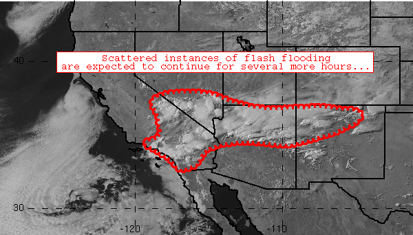
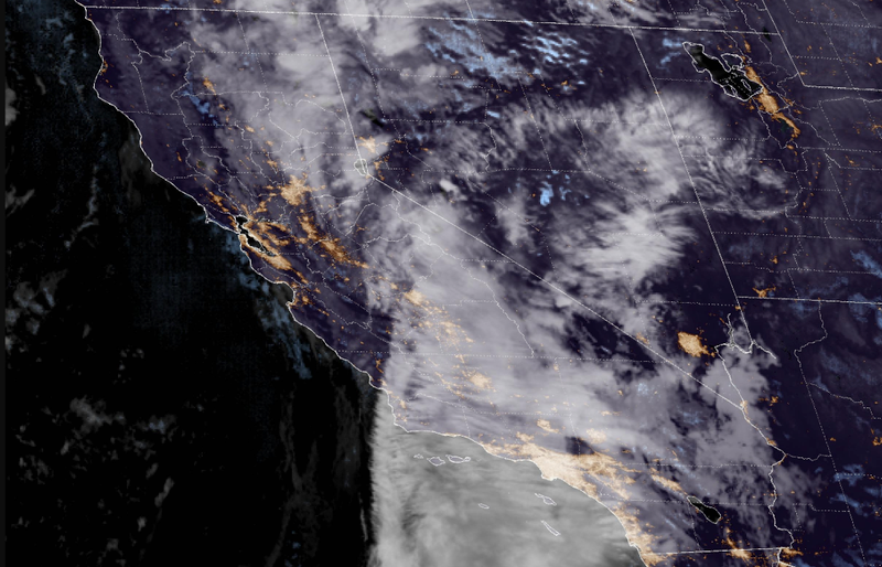
Heavy thunderstorms are triggering flash flooding across parts of Southern California and the broader Southwest, with the National Weather Service (NWS) issuing a Mesoscale Precipitation Discussion (MPD 0353) on Tuesday evening.
The bulletin warns of scattered flood impacts continuing throughout the evening. You can track current weather in Los Angeles with the interactive tool below.
Flash Flood Threat Through Late Evening
According to the Weather Prediction Center (WPC) in College Park, Maryland, a broad axis of thunderstorms has developed stretching from the Transverse Ranges and Los Angeles metro eastward into northwestern New Mexico, covering parts of:
- Southern California (including the San Bernardino Mountains)
- Southern Nevada (Las Vegas vicinity)
- Northern Arizona
- Far southern Utah
- Northwestern and north-central New Mexico
Rain rates between 0.5 to 1.25 inches per hour are exceeding local flash flood guidance (FFG) thresholds in some areas, leading to excessive runoff and scattered flash flood impacts, particularly over steep terrain, desert washes, and recent burn scars.
#WPC_MD 0353 affecting southern California, southern Nevada, northern Arizona, far southern Utah, northwestern/north-central New Mexico, #nmwx #azwx #utwx #nvwx #cawx, https://t.co/WmhLsHuaaH pic.twitter.com/fnogHoQmxJ
— NWS Weather Prediction Center (@NWSWPC) June 4, 2025
Thunderstorm Activity Driven by Heat, Moisture, and Instability
The afternoon heat across the region combined with steep atmospheric lapse rates and precipitable water values near or above 1 inch has created ideal conditions for thunderstorm development. The San Bernardino Mountains, areas near Las Vegas, and northwestern Arizona are seeing the most intense storms, with clusters persisting into the evening hours.
These slow-moving thunderstorms are expected to remain active through sunset, then begin to weaken and scatter as surface temperatures drop.
New Mexico: Isolated Threats Still in Play
The eastern extent of the storm activity has reached into northern New Mexico, where conditions are slightly less conducive to widespread flooding due to:
- Lower moisture levels (~0.65 inch PW)
- Faster mid-level wind speeds pushing storms along more quickly
Still, localized flash flooding remains a concern through about 8:00 PM MDT, especially in vulnerable areas like burn scars, dry washes, and steep slopes.
Official Monitoring and Response
The NWS has issued the alert in coordination with regional forecast offices including ABQ, FGZ, HNX, LOX, PSR, REV, SGX, SLC, and VEF, and national flood monitoring centers such as FWR, RSA, STR, TUA, and NWC.
Residents in affected areas should avoid low-lying roads and watch for rapidly rising water levels in creeks, rivers, and dry washes. Flash floods can occur with little warning, especially in rugged terrain.


