California's fire season is off to its second-fastest start in a decade; here's what that does—and doesn't—mean
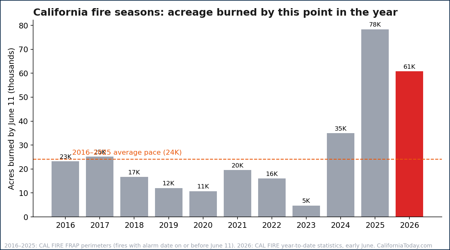
California has burned roughly 60,000 acres in 2026—about 2.5 times the average pace by mid-June, per CAL FIRE data. But 148 years of fire records show early-season acreage rarely predicts the fall. What matters: the thinnest snowpack in years and a live look at what's burning now.


Six months into 2026, California has already burned through roughly 60,000 acres, per CAL FIRE's year-to-date statistics—about two and a half times the pace of an average year at this point, and the second-fastest start to a fire season in the past decade. Only 2025, when the Palisades and Eaton fires devastated Los Angeles in the first week of January, started worse.
That number comes with essential context, in both directions. Here is what 148 years of fire records—and the conditions on the ground right now—say about the season ahead.
About the data and methodology
Historical figures come from CAL FIRE's Fire and Resource Assessment Program (FRAP) historical fire perimeter database (firep25_1 release, covering 23,334 fires from 1878 through the 2025 season), analyzed by CaliforniaToday.com. Early-season pace for 2016–2025 was computed by summing the final acreage of fires with an alarm date on or before June 11 of each year; this measures the eventual size of early-igniting fires, not acreage burned by that date. The 2026 figure is CAL FIRE's reported year-to-date total as of early June 2026. Snowpack and seasonal outlook: Utility Dive, NIFC Predictive Services, AccuWeather. Perimeter records before roughly 1950 are incomplete, so historical comparisons understate early-era fire activity. The live tracker shows mapped perimeters for significant incidents only and is not an evacuation resource.
The early pace is bad—but June rarely predicts October
In the historical record, the acreage burned by mid-June is almost noise: over the last ten years it has averaged between one and five percent of each year's final total. 2020 had the slowest start of the decade—barely 11,000 acres by June—and ended as the worst fire year in California history at 4.2 million acres. The season is decided by what happens between July and October: wind events, lightning sieges, and how dry the fuels are when they arrive.
The fuels are very dry
That last variable is the worrying one. The Sierra snowpack came out of winter at roughly 18 percent of average—among the thinnest on record—and the National Interagency Fire Center's seasonal outlooks project above-normal large-fire potential across both Northern and Southern California by July and August. Seasonal forecasters expect a heavy national fire year as drought intensifies.
The longer arc is unambiguous
Whatever 2026 brings, it arrives in the middle of the most extreme run of fire in California's recorded history. A CaliforniaToday.com analysis of CAL FIRE's historical fire perimeter database—23,334 mapped fires going back to 1878—shows the 2020s have already burned 8.88 million acres, more than any complete decade in the record, with four fire seasons still to go. The previous record-holder, the 2010s, took all ten years to reach 6.9 million. And half of all acreage ever recorded in the state has burned since 2000.
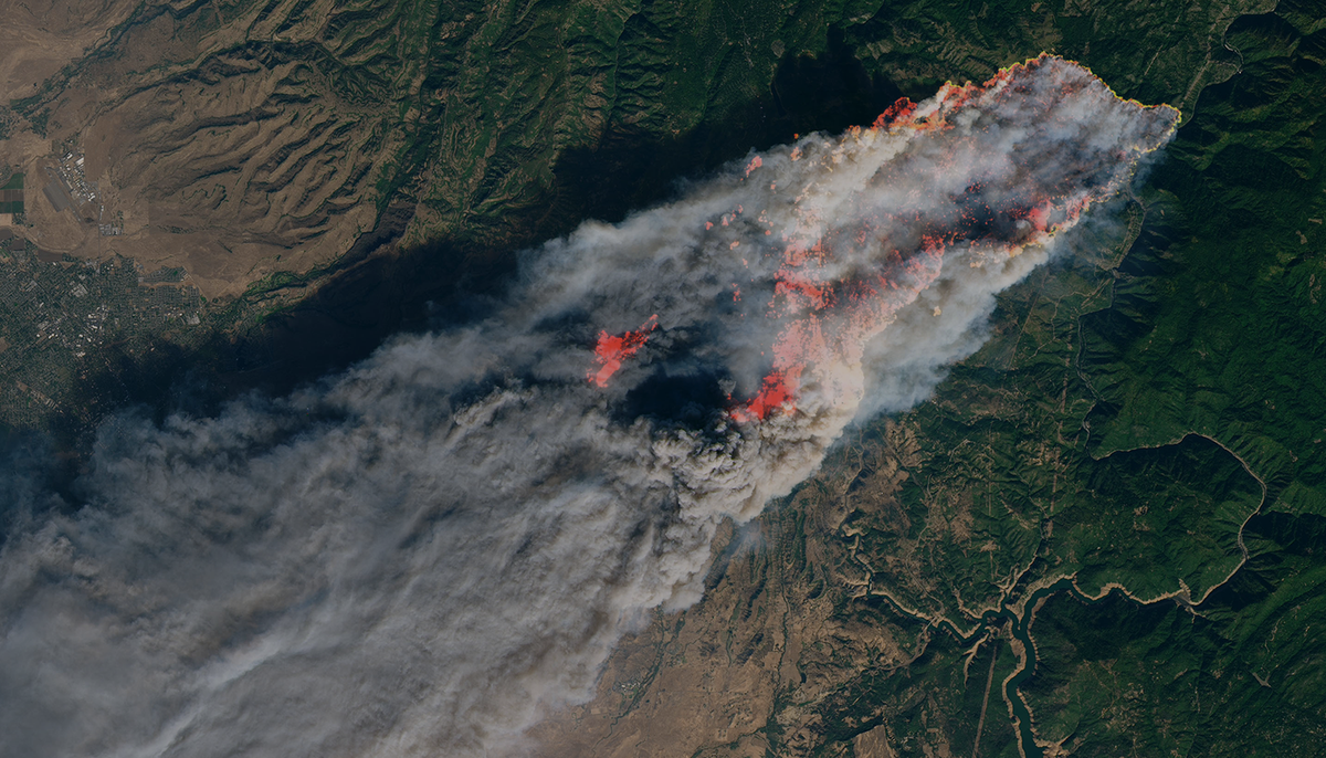
Follow the California wildfire season live
Below is our live tracker of currently mapped fire perimeters, drawing on the same FIRIS and interagency feed that powers CAL FIRE's own incident map. It updates automatically. Bookmark it through October.


